In an attempt to appreciate how the Mamluk, Ottoman, Sharkasi, and Fatimid eras influenced the architecture of Al-Moez’s Cairo, we ventured out on a walk led by Zizo Abdou, the founder of Cairo Biography, on Sunday.
Cairo Biography is a project that collects volunteers to clean up and preserve unpopular heritage sites within historic Cairo. It also creates informative and entertaining content discussing these heritage sites in detail in videos and podcasts that are posted on Cairo Biography’s Facebook page.
The reason Abdou usually picks Sundays to go on his walks is the fact that it is the only time one can actually marvel at the ancient district uninterrupted, for it is the official day off for most of the workshops in historic Cairo.
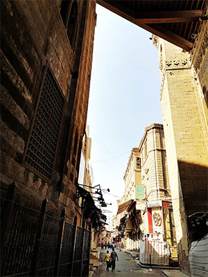
Al Ghoury Dome, side view. Photo by Amira Noshokaty
We started off on Al-Moez street, one of the oldest streets in Fatimid Cairo — a seat of power for the Shiaa-led Fatimid Caliphate which lasted from 909 to 1171 AD. Standing in the shade of Al-Goury Dome — which was built during the rule of Mamluk (The Mamluks were a sultanate of multinational former Ottoman warrior slaves that ruled over Egypt and the Levant from 1250 to 1517 AD) king Al-Ashraf Abu Al-Nasr Qonsowa Al-Goury (1501-1516 AD) — we headed off to the Daylam Alleyway.
“Al-Daylam were an ethnic group of soldiers originally from Iran, and in those days, each sect would live in an area that was named after them, like Darb Al-Atrak (The Turkish Path/Trail),” explained Abdou to Ahram Online.
He then explained that to be able to put into perspective the intangible history of the city, one needs to look into the meanings behind the names of the signs of each district.
“The Hara (Quarter) until the 19th century represented a complete neighbourhood with all its alleys and streets. However, as times changed and bigger paved roads and new districts were established, the Hara became more of an alley,” added Abdou
“When the sign reads ‘Zoqaq’, it means a narrow corridor or side path. As for ‘Atfa’, it means that it is located in a slight turn or at the end of an off ramp.”
We strolled into Al-Sharea Al-Aazam (The Greatest Street), where most of the markets lie. Passing across the Sharabish (Tarabishi) Hara and Al-Tawaqgia, we came to a very narrow path which is called Halo’um Al-Gamal (The Camel’s Throat).
The name is a metaphor that indicates how narrow the path is. This is also where the silk and textile market known as the Sweiaa of Gahrks (A small market with a ceiling) lies.
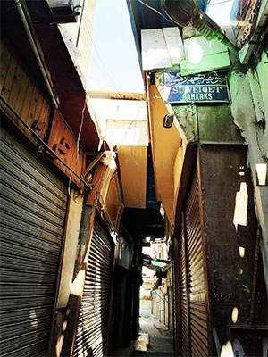
Sweiaa Gahrks. Photo by Amira Noshokaty
We then came upon Al-Fahameen (Charcoal sellers) Street, which used to be inhabited mostly by Moroccan merchants.
On the intersection of the street, where the blue sign reads ‘Al-Fahameen Street’, we came across the Sabil and Saqifa of Ottoman (The Ottoman Empire was a dynasty that controlled parts of North Africa and Eurasia from 1299 to 1922 AD) Prince Mostapha Gorbagy Mostahfezan Al-Qobrosly that were built in 1682. The term Sabil means a public drinking water dispenser; it was quite popular in Egypt back in the day. Saqifa, on the other hand, means a standalone one-story building that is mainly used as a storage area for the owner.
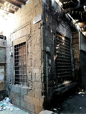
Sabil and Saqifa of Ottoman Prince Mostapha Gorbagy Mostahfezan Al Qobrosly (1682 A. D). photo Amira Noshokaty
A few metres away, we stumbled upon Al-Fakahani Mosque, which was built during the Fatimid era by khalifa Al-Zafer. It was referred to as “The Opulent Mosque” due to its lavish architecture and interior designs.
The mosque was designed to have small shops to cater for it. It was restored twice, once by the Mamluk prince Yashbak Ben Mahdi, then mostly rebuilt by Ahmed Beik Al-Kharboutly, who built a Sabil as well as a wekala (market) for selling fruits, explained Abdou.
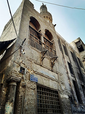
Al fakahani mosque. Photo by Amira Noshokaty
There is a folk legend affiliated with this mosque that says that a Sufi traveller came and purchased some fruits from the vendors around the mosque to distribute it to the underprivileged. After distributing for one whole day, the fruits in his possession did not decrease one bit, supposedly. So, the Sufi told the fruit seller to look after the mosque if he seeks prosperity; and from that day onwards, the mosque was called the Fakahani Mosque.
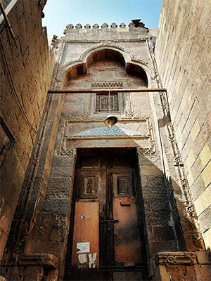
The door of Al Fakahani mosque. Photo by Amira Noshokaty
We then marvelled at the beauty of the nearby 18th and 19th century houses that are still inhabited to this day, standing tall in the face of time.
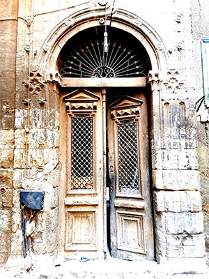
An old house dating back to the 19th century. Photo by Amira Noshokaty
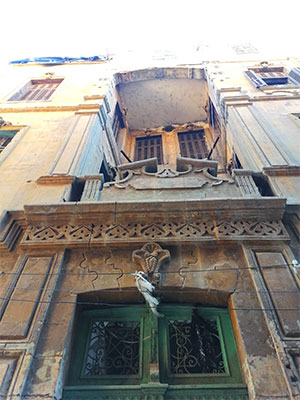
Beauty is in the details. Photo by Amira Noshokaty
Next up, we went to Haret Kshqdam, where we saw Madraset Al-Zimammeya. “This is another architectural beauty built during the Mamluk/Sharkasi era by Kafour Al-Sargatmshi Al-Roumy Al-Tawash between 1416-1426 AD,” explained Abdou to Ahram Online.
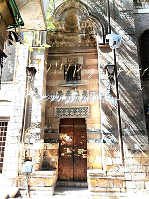
Al Madrasa Al Zimammeya. Photo Amira Noshokaty
We then came across the house of Sheikh Al-Mahrouqi, who was the Chief of Merchants during the era of the French expedition in Egypt, and the Arabesque Mashrabia — a wooden Arabesque façade that usually adorns windows. It is also derived from the Arabic verb ‘Yashrab’, meaning to drink; for this was the place where people used to put their drinking pottery water urns to cool off.
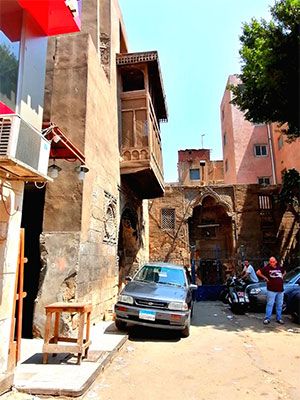
The mashrabia of Sheikh Al Mahrouqi's house. Photo Amira Noshokaty
Taking a short break, we sipped tea while enjoying the view of the mosque and the school of prince Al-Khayat Beibars, which was built in the 921st year of the Hijri calendar.
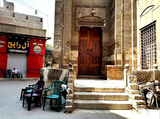
Prince Al khayat Beibars mosque. Photo by Amira Noshokaty
We resumed our walk at Bab Zewila, one of Cairo’s oldest gates. The sign on the gateway explains that Bab Zewila — also known as Bawabet Al-Metwaly during the Ottoman Era — was built by the Fatimid commander Badr Al-Gamaly in 1092 AD.
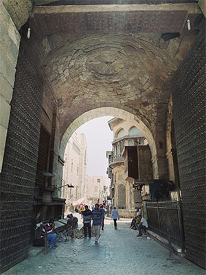
Bab Zewila. Photo by Amira Noshokaty
We ended our walk a few metres away from Bab Zewila at Nafisa Al-Bayda’s wekala, which was built in 1796 AD. Al-Bayda was married to Murad Beih, who co-ruled Egypt at the time with Ibrahim Beih.
After the death of her husband, she inherited the entire marketplace, a Sabil, and a Kuttab (A place where children are taught how to read and memorise the Quran). She is among the very few women in history to own such a complex.
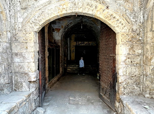
The entrance of Wekalet Nefisa Al Beida. Photo Amira Noshokaty
Short link: